Mount Whitney is the highest mountain in the United States (apart from Alaska). It is at the eastern edge of the Sierra Nevada in the state of California. On 4th September 2013, we started our two-day trip up this amazing mountain. The three days before we hiked up Mount Langley (2-day hike) and White Mountain Peak (1-day hike), both above 4,000m as well. We were therefore acclimatized for the high altitude these mountains have in common. It should be mentioned that in order to ascent Mount Whitney, a permit has to be obtained in advance and can be done here. A permit is required for 1-day hikes as well as overnight hikes. We were lucky enough to get a permit three weeks before our trip. Make sure you pack enough water with you as you need it for this high-altitude hike. We have a Katadyn water filter so that we were able to filter water from the lakes that you pass on the way up. Make sure that you only go up if the weather permits. The weather can change rapidly and you do not want to be exposed on the mountain during a storm. In general, it is always better to start your hike early during the day, as the weather usually worsens during the day.
The 2-day trip is a total of 35km (22miles) long with an elevation gain of 1,872m (6,141ft). On the first day, we started our hike at the Mount Whitney portal at 2,550m (8,360ft) with roughly 15kg of stuff in our backpack (tent, stove, water filter system, warm layers, backpack, instant food and a lot of energy bars hidden in a bear-proof container). We hiked up to to our basecamp at an altitude of 2,549m in about 6hrs. We set-up our tent at the lake just before the 99 switchbacks, shown on the map below.

Our alarm rang at 4:30am the next day. A rather strong wind was blowing the whole night and made it more difficult to get up (sleeping bags are just too cozy). Nevertheless, today was the day we would stand on top of the highest mountain in the US (again except Alaska,...) and also would hike all the way back to our car. So we packed our daypack with water and food, turned on our headlamps and started our way up the famous 99 switchbacks. Halfway through the switchbacks, the sun was rising and we stopped for a couple of minutes. This view was just incredible and breathtaking. After about 4hrs, we reached the top of Mt Whitney at 4,421m and enjoyed the view. Some tears of joy were escaping my eye.
After a 45min break at the top, we started our 1,872m (6,141ft) descent. Roughly 3hrs later we were back at our camp and cooked some warm terriyaki rice. A hot meal and a hot coffee is just what you need at that time. We packed our stuff back into our big backpacks and headed back to the car. The last 2hrs of the hike were just brutal, my knees were hurting a lot, but my motivation kept me going.
(This trip was also featured in the german online outdoor magazine:
Freisportler)
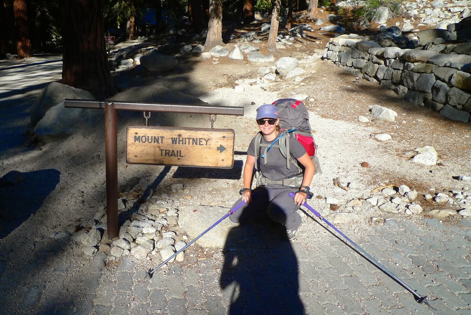 |
| The start of the trail. |
 |
| View just above Lone Pine lake into the valley. Mount Whitney is behind us. |
 |
| Our tent and our camp. Just before going to bed. |
 |
| 5am in the morning, we are ready to hike to the top. |
 |
| The sunrise halfway through the switchback |
 |
| View down to our camp. |
 |
| The morning sun |
 |
| The top of Mount Marcy with Mount Langley in the back. We were there two days earlier. |
 |
| Picture of the top to the valley. |
 |
| To US Coast & Geological Survey point |
 |
| On the way back down. |


 - 14,505ft (4,421m))
0 Comments